Tag Archives: O’Rahilly’s Villa’s

Cllr Describes Traffic/Parking Situation At O’Rahillys Villas As ‘Awful’

.
O’Rahillys Villas.

A LOCAL councillor has asked that something be done about the parking and traffic situation at O’Rahillys Villas, which he described as being “awful”.

Speaking at the meeting of Tralee Municipal District councillors last week, Cllr Terry O’Brien said O’Rahillys Villas is an old housing estate which is being used as a ring road.

“It’s awful in the middle of O’Rahillys Villas. There are big trucks going through there every day and there’s an accident waiting to happen,” he said.

Continued below…

.

He said the ‘Respect Residential Parking’ signs were having no effect, as non-residents were ignoring them and parking there at certain times.

In reply, the Council said the road there forms part of the 2020 Restoration Improvement Programme.

It is proposed to allocate €76,000 to improve the road pavement, inclusive of ramps and €35,000 on prioritised sections of footpaths within the area.

Basin Road/Low Field Junction To Get Traffic Lights

.
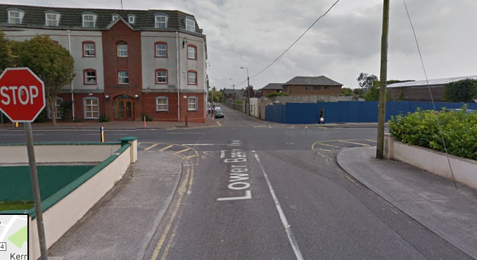
The junction at the Low Field/Basin Road which is to get traffic lights.

IT’S an issue which has come up time and time again at Tralee Municipal District meetings, but the Council is to finally take action at a junction in Tralee.

Councillors have repeatedly brought forward motions about speed and safety issues in the Basin Road/James Street/Low Field junction area.

An analysis carried out by Kerry County Council at Basin Road last year found that speed was not an issue to warrant traffic calming measures, but Tralee Municipal District revealed on Monday that there will be traffic lights forthcoming at the junction.

Continued below…

.

Responding to a motion by Cllr O’Brien that the Council “again assess the Basin Road for speed ramps, pedestrian crossing and proper junction control before there is a serious accident”, Council management said Tralee MD has been successful in its request for Department funding to install a ‘Fully Adaptive Traffic Control System’ consisting of traffic lights with pedestrian facilities at the junction.

However, it may be a while yet before we see any work starting there. They are currently in the process of preparing the Section 38 approval which requires a detailed design and report and then this will have to come before councillors for consideration.

Have You Noticed The Lights Have Gone Out In Parts Of Tralee?

Evolution Insert
.
O'Rahilly's Villas in darkness in the absence of street lighting. Photo by Gavin O'Connor.
Taken from the Low Field, this is what O’Rahilly’s Villas looked like last night up to Strand Road. Photo by Dermot Crean.

HAVE you noticed it’s gone dark in parts of Tralee over the past couple of weeks? We have.

The stretch of road from the Strand Road entrance to O’Rahilly’s Villas right down to the junction by the Low Field has been in darkness for about two weeks, as well a stretch of road from the bridge near Na Gaeil GAA club to the traffic lights at the Oakpark road has no street lighting for about a week.

While pedestrians are safe enough from traffic – as there is footpaths in both areas – it’s still inconvenient as someone could trip up on uneven paths, or step into something unsavoury!

Speaking to Traleetoday.ie earlier today, Frank Hartnett of Kerry County Council said it’s the first he had heard of the outages.

“Normally someone would give us a ring and we would ring Airtricity who have the maintenance contract on the lights,” said Frank.

“Normally when there’s a light out, we hear about it fairly quickly. We make a call to Airtricity and it gets logged onto their system, they then have ten days to repair it,” he continued.

“We find Airtricity quite good at responding, but then again they won’t know if they’re not told. Every month they inspect the lights and fix any bulbs.”

We contacted Airtricity this afternoon and they said they would get back to us as soon as possible about the issue. In the meantime, watch how you go.

Scroll down for photos…

The area around Cliffords Cash and Carry on Basin Road. Photo by Dermot Crean.
The entrance into O'Rahilly's Villas from Strand Road. Photo by Gavin O'Connor.
The entrance into O’Rahilly’s Villas from Strand Road (the lights in the distance were the Low Field floodlights which were on at the time). Photo by Gavin O’Connor.

More Old Tralee! This Time, Aerial Photos Of The Town From The 1950s

Roundys insert

WE received a huge response to the aerial photos of Tralee in the 1930s which we put up on the website on Wednesday (here).

Following on from that, we also came across the only other aerial shots of the town on the ‘Britain From Above’ website, this time from the mid-1950s.

Along with the full photos, we have zoomed in on a few parts of the town in particular, which have changed so much to the way they are now.

Continued below…

Credit Union 600x400


  • BELOW: At the bottom of the image is the Strand Road area, that isolated estate on the middle left of the image is St Brendans Park.

1933.8


Continued below…

Hannons 1

  • BELOW: A closer look at St Brendans Park as it was 61 years ago, with no other estates around it.

SBP 1953

  • BELOW: St Brendans Park from another angle, note the dog track in the bottom right corner.

SBP 1953.2

  • BELOW: O’Rahilly’s Villa’s and the Strand Road area. Judging by the marks on The Low Field, on the right of the image, it was seeing plenty of action at the time. It has done well to survive all the development in town over the last 60 years.

O'Rahilly's 1953

  • BELOW: A closer look of what now is the Abbey Inn area. Back then it looks to have been mainly  buildings once known as The ‘Casbah’. See, at the top right, The Square, and at the bottom centre, the back of Dominican Church.

Abbey 1953

  • BELOW: The view of the town, from Austin Stacks Park in the middle right, stretching straight across to the Ashe Memorial Hall.

1933.6

  • BELOW: Austin Stacks Park and the Mitchel’s area of town as it was.

Stacks Park

  • BELOW: Oakpark has seen a bit of change since! The Dog Track is in the bottom left hand corner. Oakpark road, goes from the bottom right corner to the top left. Racecourse Rd, is in the middle right.

Oakpark 1953

  • BELOW: A zoomed in look at Balloonagh/Caherslee area. The Balloonagh convent is in the middle right.

Ballonach.1953

  • BELOW: The centre of town. The Court House is on the top, centre.

centre 1953

  • BELOW: The Square along with the old mart at the top of the image.

Mart 1953